This section followed some very pleasant footpaths through woods and fields, down in the southern tip of Derbyshire. Toby and Theo joined me for the first, shorter, walk; I did the second larger loop by myself. Stage 8 of the NFW actually runs from Rosliston to Conkers, but I stopped a couple of kilometres short, in Overseal.
Walk One
It was a sunny Saturday. Perfect walking weather, I thought, but I hadn't realised it was also the day of the FA Cup Final. Toby was keen to make it back by 3pm for kick-off, which gave us quite a tight deadline to complete our hike. I certainly had no complaints about the boys dawdling!
 |
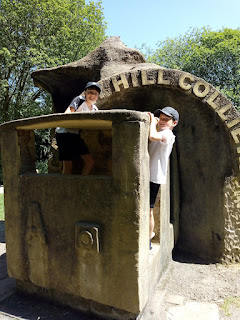
| Coalmining sculpture at Rosliston |
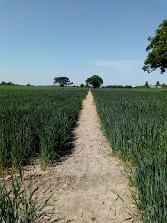
We walked past some familiar landmarks at Rosliston Forestry Centre, then followed a path in a large curve around the edge of a wood. The route then crossed a classic summer wheatfield - green stalks and baked brown earth - to reach Penguin Wood. Sadly there were no native penguins; the trees were apparently planted in partnership with Penguin Books. Our turning point was the tiny hamlet of Botany Bay, which doesn't appear to have any connection with its Antipodean namesake. We followed a quiet country lane back to Rosliston village and the Forestry Centre.
 |
| classic summer wheatfield |
Our car pulled into the drive back home at 5 past 3, but the first goal of the match had already been scored. Still, I think the remaining 85 minutes were reasonably exciting, so all was not lost.
Walk Two
There was definitely a car park on both the OS map and Google street view, but I failed to find it on the ground, so I parked on a side street in Overseal instead. That meant I started by doing the non-NFW part of my loop, heading west via Linton to pick up the route at Botany Bay again.
 |
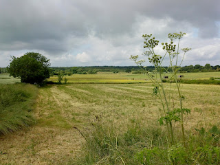
| View from Overseal |
I was very glad I'd brought my waterproof trousers this time! It had rained hard the night before, and every grass stem carried a load of water. Since some of the grass was above my waist, I might as well have jumped in a paddling pool. I waded past barking dogs and over a long-defunct railway embankment.
 |
| Very long grass! |
 |
| Back on the NFW |
Then the sun came out and the world promptly turned into a steam room. At least the path was clearer by then, so I was able to take off the waterproof trousers. They came in handy to sit on while I had a snack. I skirted a wood with signs saying, "Danger. Keep Out." and went past Grangewood Hall, which looked like a pastoral painting, with cows grazing peacefully in the foreground.
The National Forest Way didn't quite get to Netherseal, but I decided to take a detour anyway. Netherseal and its neighbour Lullington are the southernmost villages in Derbyshire. The River Mease forms the boundary. I crossed the river and tried to guess which county I was now in. It turned out to be Leicestershire - but to my surprise, it could almost have been Warwickshire. There's about a mile of boundary between Staffordshire and Leicestershire, and then the top of Warwickshire reaches up to nearly touch the bottom of Derbyshire.
Netherseal is the burial place of Sir Nigel Gresley, who designed the Flying Scotsman and Mallard locomotives. There is a little model of Mallard on his grave. Unfortunately my phone threw a wobbly and lost all the photos I took on the second half of the walk. So here's a Wikimedia photo of Mallard instead.
 |
| By BWard 1997 - Own work, CC BY 3.0, https://commons.wikimedia.org/w/index.php?curid=121639534 |
I headed north and uphill back to Overseal, where I rewarded myself with an ice cream from the village shop. This had been one of my longest and stickiest walks so far. The ice cream definitely hit the spot!
Previous sections:


Comments