Remember when it was lockdown and we were all stuck in our houses for months on end? Well, way back then I hatched a plan of walking the National Forest Way as a family project. I ordered the map, downloaded the route guides, and we did the first section in 2021: Yoxall to the National Memorial Arboretum (Stage 12).
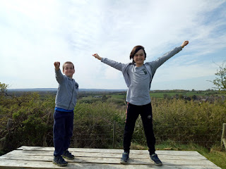
The photos tell me it was a beautiful April day - I was wearing shorts! The 5-mile route was pleasant, across fields and through scraps of woodland, then hopping over the Trent and Mersey Canal into the village of Alrewas. After that we had a hair-raising walk along a pavement right next to the A38 dual carriageway, with cars zipping past at 70mph, but fortunately that was a very short section before we turned off towards the National Memorial Arboretum. Of course we had to celebrate with an ice cream - why else would we finish at the Arboretum instead of starting there?
 |
| Smaller boys! Lockdown haircuts! |
 |
| At the finishing point |
 |
| A well-deserved treat |
There followed a very. long. gap. The next part of the route didn't look that exciting, to be honest; it had been a bit of a hassle parking a car at each end so as to be able to do a one-way walk; and the rest of the family weren't quite as interested in this project as I was.
But the idea never quite went away, so in April this year I dusted off the OS map and realised I could make the next few sections into some nice loops, thus removing the need for two cars. Of course, this meant I couldn't get quite as far along the trail in one go, but that didn't matter.
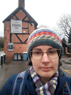
So, almost two years after walking Stage 12, I set out from Yoxall again, this time heading north for Stage 11. The route was mostly country lanes and fields - not too exciting, but enlivened by a beautiful wood full of daffodils. It had been raining hard so I was glad for wellies. I was also glad that the fords en route came with footbridges; the streams were running too fast for me to attempt them, even in waterproof boots. I had a snack at the picnic area at Jackson's Bank (my turnaround point) and made it back to Yoxall for lunch.
 |
| Setting off from Yoxall |
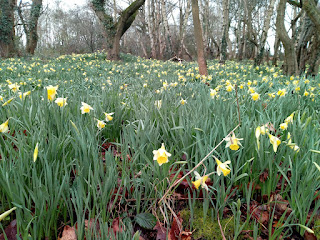 |
| Daffodils in Woodmill woods |
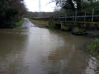 |
| One of the two fords |
The second half of this section took me from Jackson's Bank to the tiny village of Rangemore. It was a gorgeous Easter Saturday with tons of sunshine. Graham and the boys had gone to see the racing at Donington Park, so I had plenty of walking time. The wood near the car park was full of families, but after that first half-mile I hardly saw another person. I disturbed a few pheasants, though!
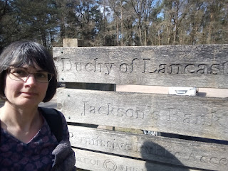 |
| Jackson's Bank (owned by the Duchy of Lancaster) |
 |
| First bluebells I've seen this year |
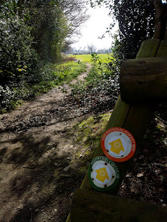 |
| NFW waymarkers |
There was a regular hum of light aircraft taking off from Tatenhill Airfield. The path ran alongside the airfield, then around St George's Park National Football Centre. Rangemore was quiet, but someone had thoughtfully provided a picnic bench in a square of woodland next to the church. After lunch, I retraced my steps for a mile or so, then ducked onto the Cross Britain Way for a short section. It took me through a very pretty woodland. Then I headed across some fields, with enormous views south, and back to my starting point.
 |
| The dome of the National Football Centre |
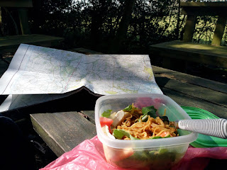 |
| Lunch break! |
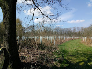 |
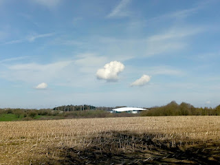
| National Forest in progress |
It may well take another two years to reach Beacon Hill - the eastern end of the National Forest Way. But I'm planning out the next few stages, so watch this space. I may even bring the family along on some of it, too.


Comments